All-In-One Offline Maps 3.15 Apk for Android

updateUpdated
offline_boltVersion
3.15
phone_androidRequirements
2.1
categoryGenre
Apps, GPS
play_circleGoogle Play
The description of All-In-One Offline Maps
No advertisements ~ No data sharing & monetization ~ No analytics ~ No third party libraries
Bored to wait for maps to display? Use All-In-One OfflineMaps! Once displayed, maps are stored and remain available, quickly, even with no network access.
• Want more than just roads on your maps? You will find what you need here;
• Used to go to places with poor network coverage? Everything will stay available;
• Used to go abroad? You won’t be lost anymore;
• Have a data allowance limit? It will reduce your usage.
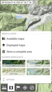
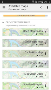
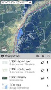
★★ Maps ★★
A lot of maps are available, including classical road maps, topographic maps, aerial (satellite) maps and various layers that can be added over any maps: OpenStreetMap (Roads, Topo), USGS National Map (Hi-res topo, Aerial imagery), Worldwide Military Soviet topo maps, etc.
• All maps can be stacked in layers, with precise opacity control;
• Select and store large areas in few clicks;
• Stored space is clear and can be easily deleted.
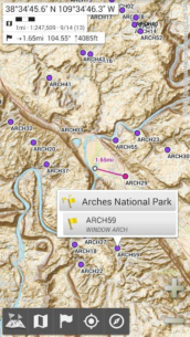
★★ Display, store and retrieve unlimited placemarks ★★
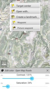
You can add various items on the map such as waypoints, icons, routes, areas and tracks.
You can easily manage them using the powerful SD-Card Placemarks Explorer.
★★ On-map GPS Location & Orientation ★★
Your real location and direction are clearly displayed on the map, which can be rotated to match your real orientation (depends on device capabilities).
Easy turn on/off to save battery.
And also:
• Metric, imperial and hybrid distance units;
• GPS Latitude/Longitude and grid coordinate formats (UTM, MGRS, USNG, OSGB Grid, Irish Grid, Swiss Grid, Lambert Grids, DFCI Grid, QTH Maidenhead Locator System, …);
• Ability to import hundreds of coordinate formats from https://www.spatialreference.org;
• On-map grids display;
• Full screen map view;
• Multi-touch zoom;
• …
★★ Need more? ★★
If you are a real adventurer, try AlpineQuest Off-Road Explorer, the complete outdoor solution based on All-In-One OfflineMaps, loaded with a powerful GPS Track Recorder and more: https://www.alpinequest.net/google-play
What's news
The complete list is available in the changelog inside the application.
3.15
• Added ability to display arrows, distances and ETE along the real-time location and compass heading lines;
• Added duration estimation of drawn paths and routes based on the selected activity, with time estimations of each route legs displayed on the map;
• Added new fields in the Explorer mode: North and target direction arrows;
• Added new imperial distance unit using meters instead of feet;
• And more
Download All-In-One Offline Maps mod apk
All-In-One-Offline-Maps-3.15.apk
Download apk - 7 MB
 0.6.3 Apk + Mod for Android 2")


 3.0.0.257 Apk for Android 11")
 2.3.2 Apk for Android 12")
 1.2.5 Apk for Android 13")
 5.2.13 Apk for Android 14")
 2.36.10119 Apk for Android 15")
 2.2 Apk for Android 16")

 2.1.4 Apk for Android 18")
